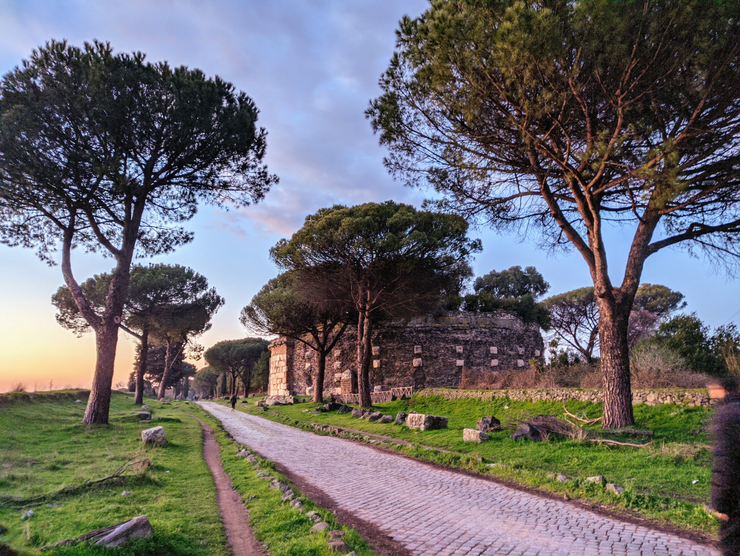
It’s easy to miss how much of the ancient world is still right under our feet. Roman roads have a way of hiding in plain sight. A suspiciously straight country lane in England. A stretch of cobble exposed in a French field after a dry summer. A modern highway in Italy that runs perfectly level for miles while the landscape rolls away on either side. These are not ruins in the usual sense. They never stopped being used.
The Romans began building their first major road in 312 BC. It ran south from Rome to Capua and later reached all the way to Brindisi on the Adriatic coast. They called it the Via Appia. The project had a straightforward purpose: moving troops during the Samnite Wars. Over the next several centuries, the network grew to somewhere around 250,000 miles, stretching from Britain to North Africa and from Portugal to Mesopotamia.
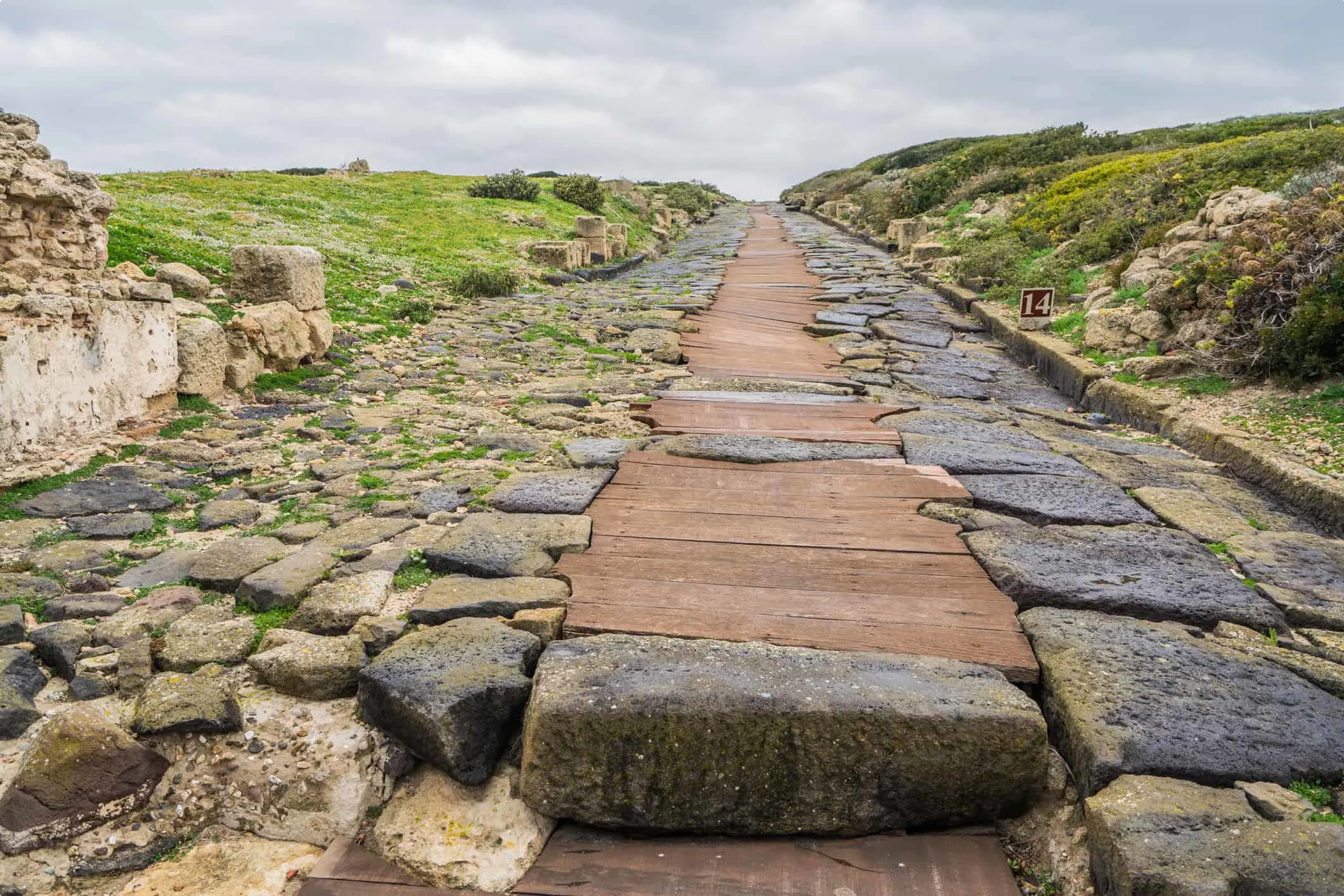
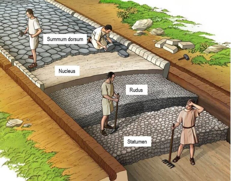
What made the roads hold up so well was the construction method. Roman builders dug a trench, sometimes several feet deep, and filled it in layers. Large stones at the bottom for drainage, then gravel and sand, then tightly fitted paving stones on top. The surface curved slightly so water ran off into ditches on either side. This system kept the roads passable in weather that turned other routes into mud for weeks at a time. The same basic idea appears everywhere Roman engineers went, though they adjusted materials based on what was available locally.
The military value of the roads is the part people talk about most, and for good reason. Legions could march twenty miles a day on a decent road without exhausting themselves. Supplies followed behind on carts. Messengers on horseback relayed information across provinces in a fraction of the time it would have taken a generation earlier. When a rebellion broke out in Gaul or a border incursion happened along the Danube, Rome could respond faster than anyone expected.
The economic changes that followed the roads were slower but deeper. Farmers who used to sell only to their neighbors could now send goods to towns three days away and still turn a profit. Pottery from one region turned up in markets across the empire. Grain, wine, olive oil, metalwork, textiles—the whole Mediterranean economy began to connect in ways that had never been possible before. Coastal trade routes handled the heaviest cargo, but inland, the roads did the work.
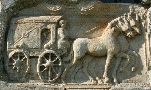
Travel in the Roman world was not glamorous. Wealthy travelers stayed in official guesthouses called mansiones, which offered a bed, a meal, and fresh horses. Everyone else made do with roadside inns that had reputations for bedbugs and watered wine. Carts had no suspension, and the iron-rimmed wheels on stone made noise that kept whole neighborhoods awake at night. Rome itself banned most wheeled traffic during daylight hours simply because the streets became impassable otherwise.
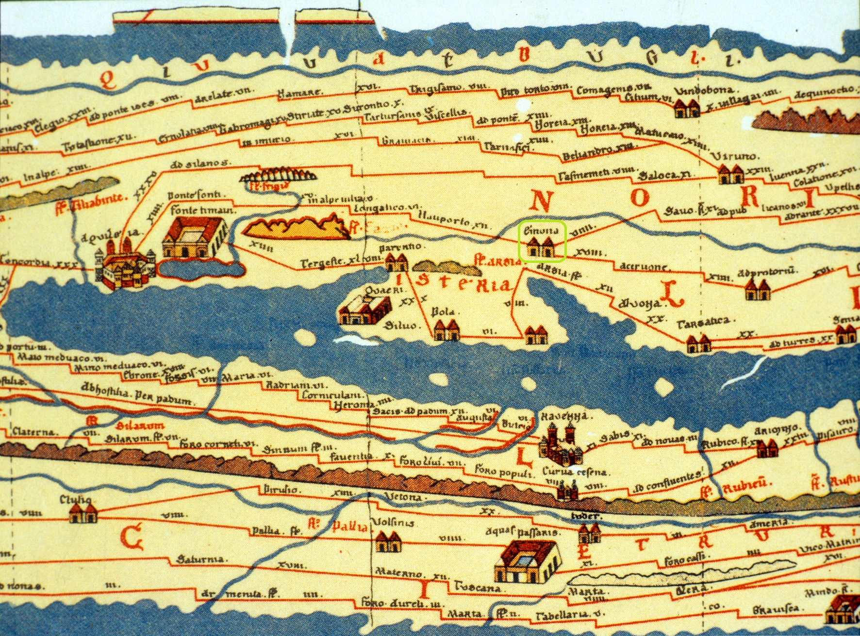
For navigation, Romans used itineraries—lists of stops along a route with distances between them. The Peutinger Table, a medieval copy of one such Roman map, survives today. It shows the empire stretched across a scroll about twenty-two feet long and only one foot wide. The geography is distorted beyond recognition, but the roads and the distances are marked clearly enough that someone could plan a journey from Spain to India using nothing else.
When the western empire unraveled, the system behind the roads unraveled with it. No central authority meant no coordinated repair work. Bridges collapsed. Drainage ditches filled in. Some stretches fell out of use and vanished under farmland or forest. Many others simply stayed in use because they were still the best way to get from one place to another. Medieval travelers walked them. Farmers carted produce along them. Parishes used them as boundary lines. In time, modern road builders paved over them, often following the same path.
In Britain, a surprising number of straight roads turn out to sit directly on top of Roman alignments. The same is true in France, Italy, Spain, and parts of North Africa. A route that connected a river crossing to a market town two thousand years ago often still connects them today. The towns might have different names. The carts are now cars. But the logic of the landscape hasn’t changed, and the old line through it remains the obvious choice.
This is the quieter side of Roman engineering. Aqueducts stand as ruins you visit. Amphitheaters are fenced off and ticketed. Roads, though, are lived in. They accumulate new layers of asphalt and concrete. They get widened and realigned at the edges. But the core decision—where to go, how to cross this valley, which ridge to follow—still belongs to a surveyor who stood there with basic tools and a clear idea of what was needed. That kind of mark on the world doesn’t fade easily.